Is the oldest map in Europe in France?
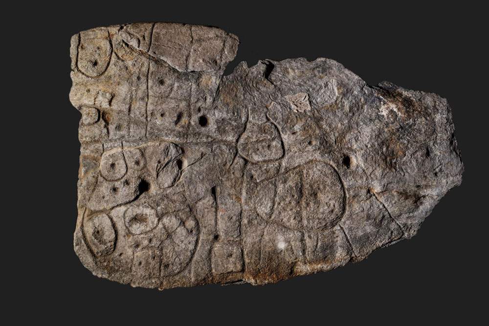
The Saint-Bélec slab is probably the oldest map in Europe. A multidisciplinary study on the latter was recently published by Inrap (French Institute of Archaeological Investigations): it dates back 4,000 years and has been forgotten for more than a century in the deposits of the National Archaeological Museum; in fact, it was donated to the museum in 1924 by the man who discovered it in 1900, Paul du Chatellier. However, the slab was rediscovered in 2014, and studies on it then began in 2017.
It constituted the low wall of a Late Bronze Age burial vault and had been subsequently reutilised, as evidenced by the engravings on its surface: ovals, notches, straight and curved lines that repeat. The discoverer was a scholar of Breton prehistory and even he did not understand its meaning: “It is difficult to describe it. Some people see in it a shapeless human representation and that of an animal.”
The research team believes it is a cartographic representation because of the repetition of signs that are connected by lines, forming a network, a coherent whole. With the help of modern tools such as photogrammetry and 3-D scanning, it was discovered that this map constituted not only an ancient plot but also atopographical engraving of the space represented, measuring about 630 kilometers. It would only take finding archaeological traces of these plots to have definitive proof of the cartographic character of the Saint-Bélec slab.
According to Inrap experts, it could represent the territory of a highly hierarchical political entity that controlled a specific territory in the early Bronze Age.
Ph.Credit Denis Glicksman, Inrap
 |
| Is the oldest map in Europe in France? |
Warning: the translation into English of the original Italian article was created using automatic tools. We undertake to review all articles, but we do not guarantee the total absence of inaccuracies in the translation due to the program. You can find the original by clicking on the ITA button. If you find any mistake,please contact us.


